


Saemangeum Images April 2005
Please feel free to download and use these images to help us fight the Saemangeum Reclamation Project.
Please credit all images © Birds Korea 2005.
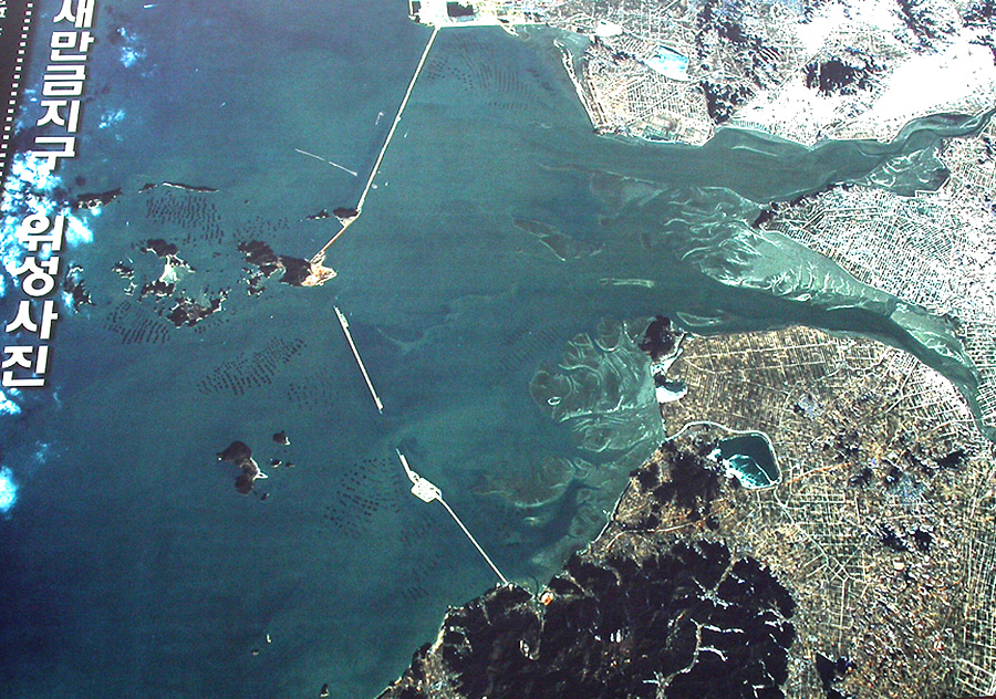
An aerial photograph of the Saemangeum reclamation, as displayed at the Saemangeum centre. Aerial photograph apparently taken during the winter of 2004/2005, at neap tide. The estuaries of the Mangyeung (upper) and Dongjin (lower) are clearly visible, as are extensive areas of tidal-flats (rather more extensive at low tide). Most of the hinterland (brown areas) are rice-fields, many reclaimed in the 1960s. Two large gaps remain in the sea-wall; but no tidal-flats are visible outside of the seawall. The dark lines outside of the wall near the islands are aquaculture platforms and rafts, demonstrating the still enormous economic value of the area for fisheries.
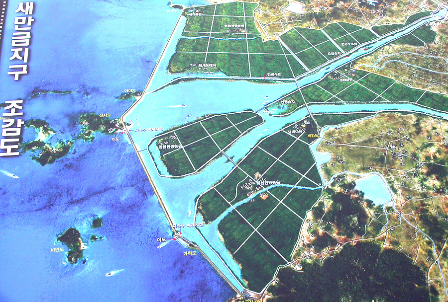
A diagrammatic representation of the "finished" reclamation, displayed at the Saemangeum centre. Note both how much construction remains to be done before completion, and that the diagram still claims the area will be used for rice agriculture (it will not). Note also how this "environmentally friendly" reclamation will involve the straightening of both rivers; the draining and cultivation of all the tidal-flats; and the conversion of all remaining estuarine areas into freshwater reservoirs.
Too small to make out, a bird reserve is proposed for the area where the two rivers meet...
Too small to make out, a bird reserve is proposed for the area where the two rivers meet...

A totem pole stands on the tidal-flats, protesting the reclamation (March 2005).

View looking north from the southern section of the massive seawall (March 2005): sea to the left (where no tidal-flats), and brackish shallows to the right.
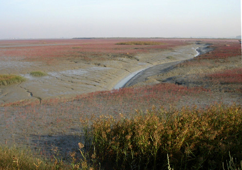
Salt-marsh at the Dongjin estuary (August 2004).