List of MoE Winter Census Locations
MoE Locations map
  1. Cheorwon basin
    (1999-2013)
    38°16'44.81"N; 127°13'31.48"E
  2. Yeoncheon
    (2005-2013)
    37°59'47.21"N; 126°57'41.82"E
  3. Haengju Bridge - Paldang Dam
    (1999-2004)
    37°32'11.93"N; 126°55'1.04"E
  4. Seongsan Bridge - Paldang Dam
    (2005-2007)
    37°33'39.04"N; 127°7'46.50"E
  5. Seongsan Bridge - Seongsu Bridge
    (2008-2013)
    37°30'33.05"N; 126°58'52.30"E
  6. Seongsu Bridge - Paldang Dam
    (2008-2013)
    37°35'10.75"N; 127°11'25.12"E
  7. Jungnang Stream
    (1999-2013)
    37°33'3.45"N; 127° 3'30.11"E
  8. Tan Stream
    (1999-2013)
    37°30'3.70"N; 127° 4'28.04"E
  9. Paldang Lake
    (1999-2013)
    37°30'20.78"N; 127°17'56.20"E
  10. Gyeongancheon
    (1999)
    37°27'57.79"N; 127°17'53.53"E
  11. Namhan River
    (2000-2013)
    37°30'16.84"N; 127°27'8.25"E
  12. Hoengseong Lake
    (2010-2013)
    37°33'17.53"N; 128° 3'28.57"E
  13. Namhan River
    (2010-2013)
    37°13'40.22"N; 127°43'38.72"E
  14. Seom River
    (2010-2013)
    37°18'22.06"N; 127°48'27.49"E
  15. Bukhan River
    (1999-2013)
    37°51'20.22"N; 127°40'48.53"E
  16. Cheongpyeong Dam
    (1999)
    37°42'17.55"N; 127°28'17.59"E
  17. Lower reaches of Soyang Lake
    (2011-2013)
    37°55'39.92"N; 127°47'4.90"E
  18. Seongsan Bridge - Haengju Bridge
    (2010-2013)
    37°34'6.27"N; 126°51'32.48"E
  19. Anyang Stream
    (2005-2013)
    37°29'30.54"N; 126°52'12.22"E
  20. Han River Estuary, Hongdopyung
    (1999-2013)
    37°42'53.22"N; 126°40'26.44"E
  21. Han River downstream
    (2011-2013)
    37°36'2.11"N; 126°48'13.30"E
  22. Imjin Estuary
    (1999-2013)
    37°50'27.21"N; 126°42'9.83"E
  23. Odusan Tongiljeonmangdae - Haengju Bridge
    (1999)
    37°39'19.66"N; 126°42'5.37"E
  24. Ganghwa Island
    (1999-2013)
    37°35'40.78"N; 126°26'46.76"E
  25. Seokmo Island
    (2008-2013)
    37°41'35.35"N; 126°18'59.25"E
  26. Gyodong Island
    (2008-2013)
    37°47'0.01"N; 126°15'16.63"E
  27. Yeongjongdo Unbookdong
    (2000-2013)
    37°31'9.40"N; 126°32'0.48"E
  28. Yeongjongdo Unnamdong, Sammokdong
    (2000-2013)
    37°25'12.40"N; 126°25'50.10"E
  29. Songdo
    (2006-2013)
    37°22'27.99"N; 126°38'26.80"E
  30. Cheongra, Gulpo stream
    (2011-2013)
    37°34'5.35"N; 126°35'27.59"E
  31. Daebu Island
    (2000-2013)
    37°13'40.28"N; 126°33'59.53"E
  32. Shihwa Lake
    (1999-2013)
    37°18'12.86"N; 126°40'7.62"E
  33. Wangsong Reservoir
    (2010-2013)
    37°18'18.84"N; 126°56'49.83"E
  34. Mulwang Reservoir
    (2010-2013)
    37°22'54.05"N; 126°50'5.77"E
  35. Balan Reservoir
    (2011-2013)
    37°10'6.09"N; 126°55'35.40"E
  36. Jinwi Stream
    (2011-2013)
    37°5'52.40"N; 127° 3'23.77"E
  37. Idong Reservoir
    (2011-2013)
    37°6'40.49"N; 127°11'58.23"E
  38. Gosam Reservoir
    (2011-2013)
    37°4'48.04"N; 127°16'53.73"E
  39. Namyang Bay
    (1999-2013)
    37°5'9.62"N; 126°43'35.67"E
  40. Namyang Lake
    (1999-2013)
    37°0'44.25"N; 126°49'17.03"E
  41. Asan Bay
    (2000-2013)
    36°55'4.93"N; 126°51'8.18"E
  42. Asan Lake
    (2000-2013)
    36°55'13.86"N; 126°57'36.97"E
  43. Sapgyo Lake
    (2000-2013)
    36°51'22.33"N; 126°50'21.55"E
  44. Asan - Sapkyo
    (1999)
    36°53'8.09"N; 126°53'30.00"E
  45. Yedang Reservoir
    (1999-2013)
    36°36'58.96"N; 126°47'54.76"E
  46. Seokmun Reclaimed Area
    (2000-2013)
    36°59'22.24"N; 126°38'36.21"E
  47. Daeho Lake; Reservoir
    (1999-2013)
    36°59'0.89"N; 126°28'35.18"E
  48. Garorim Bay
    (2011-2013)
    36°53'46.83"N; 126°21'45.39"E
  49. The seaside of Iwon-myeon, Taean
    (2010-2013)
    36°54'32.15"N; 126°14'26.30"E
  50. The seaside of Geunheung-myeon, Taean
    (1999-2013)
    36°44'23.14"N; 126° 7'46.57"E
  51. Suryong Reservoir
    (2010-2013)
    36°45'9.34"N; 126°14'0.91"E
  52. Taean-gun Nam-Myeon Coast
    (2000-2013)
    36°39'42.68"N; 126°16'47.78"E
  53. Anmyeondo
    (2010-2013)
    36°30'35.89"N; 126°19'26.96"E
  54. Daecheong Lake
    (1999-2013)
    36°24'29.91"N; 127°30'8.84"E
  55. Baekgok Reservoir
    (2000-2013)
    36°51'48.07"N; 127°23'56.31"E
  56. Chopyeong Reservoir
    (2000-2013)
    36°49'6.43"N; 127°30'39.58"E
  57. Goesan Lake
    (2010-2013)
    36°44'32.03"N; 127°50'30.35"E
  58. Chungju Lake
    (1999-2013)
    36°57'36.16"N; 128°4'10.54"E
  59. Ganwol Lake
    (1999-2013)
    36°37'3.70"N; 126°27'10.52"E
  60. Bunam Lake
    (1999-2013)
    36°39'24.12"N; 126°21'12.03"E
  61. Nonsan Reservoir / Tapjeong Reservoir
    (1999-2013)
    36°10'25.36"N; 127°10'33.01"E
  62. Miho River
    (2008-2013)
    36°36'39.53"N; 127°20'54.59"E
  63. The upper Stream of Geum River
    (2008-2013)
    36°29'2.47"N; 127°17'12.30"E
  64. Midstream of Geum River
    (2010-2013)
    36°15'11.15"N; 126°55'24.26"E
  65. Jamhong Reservoir
    (2000-2013)
    36°47'32.94"N; 126°29'30.25"E
  66. Seongam Reservoir
    (2000-2013)
    36°47'9.13"N; 126°32'12.77"E
  67. Inpyeong Reservoir
    (2000-2013)
    36°45'26.66"N; 126°20'47.42"E
  68. Poongjeon Reservoir
    (2000-2013)
    36°46'38.93"N; 126°25'22.31"E
  1. Hwangam Reservoir
    (2000)
    36° 7'2.44"N; 127° 9'40.38"E
  2. Gyeongcheon Reservoir
    (1999-2013)
    36°1'46.13"N; 127°14'2.78"E
  3. Daea Reservoir
    (2001-2013)
    35°58'28.50"N; 127°16'18.61"E
  4. Dongsang Reservoir
    (2001-2013)
    35°57'4.64"N; 127°16'32.04"E
  5. Janghang Coast
    (2000-2013)
    36°3'7.67"N; 126°38'14.09"E
  6. Bongseon Reservoir
    (2000-2013)
    36°7'32.51"N; 126°46'30.00"E
  7. Busa Reclaimed Area
    (2005-2013)
    36°10'54.77"N; 126°31'53.47"E
  8. Yubu Island
    (2000-2013)
    35°59'44.34"N; 126°36'39.18"E
  9. Geum River Estuary
    (1999-2013)
    35°59'50.21"N; 126°41'29.47"E
  10. Lower Reach of Geum River
    (1999-2013)
    36°2'13.34"N; 126°48'53.60"E
  11. Mankyung River
    (1999-2013)
    35°52'9.22"N; 126°42'22.78"E
  12. Okgu Reservoir
    (1999-2013)
    35°55'43.23"N; 126°39'26.72"E
  13. Okryeo Reservoir
    (2011-2013)
    35°56'48.84"N; 126°37'33.30"E
  14. Dongjin River
    (1999-2013)
    35°48'20.63"N; 126°41'24.74"E
  15. Cheongho Reservoir
    (1999-2013)
    35°44'19.57"N; 126°39'50.68"E
  16. Joryuji
    (1999-2013)
    35°46'14.29"N; 126°37'51.11"E
  17. Neungie
    (2010-2013)
    35°50'45.30"N; 126°49'33.33"E
  18. Baeksan Lake
    (2010-2013)
    35°50'39.78"N; 126°53'39.44"E
  19. Gomaje
    (2010-2013)
    35°44'22.18"N; 126°45'28.18"E
  20. Jangseong Lake
    (2008-2013)
    35°23'45.55"N; 126°50'34.08"E
  21. Damyang Lake
    (2008-2013)
    35°23'29.77"N; 127° 0'29.61"E
  22. Okjeong Lake
    (2008-2013)
    35°34'36.58"N; 127°6'37.40"E
  23. Youngsan River
    (2011-2013)
    35°14'21.04"N; 126°52'29.08"E
  24. Donglim Reservoir
    (1999-2013)
    35°32'46.33"N; 126°43'10.57"E
  25. Gomso Bay
    (1999-2013)
    35°33'36.89"N; 126°32'35.13"E
  26. Donghohang - Gaemahang
    (2010-2013)
    35°28'7.20"N; 126°27'11.93"E
  27. Beopseongpo
    (2010-2013)
    35°22'18.28"N; 126°24'22.64"E
  28. Yeonggwang - Hampyeong Coast
    (2011-2013)
    35°15'21.12"N; 126°18'41.17"E
  29. Hampyeong Daedong Dam
    (2006-2013)
    35°7'19.97"N; 126°31'34.05"E
  30. Hyeongyeong-myeon & Unnam-myeon, Muan-gun
    (1999-2013)
    35°5'56.55"N; 126°22'9.06"E
  31. Haeje-myun, Jido-eup
    (2000-2013)
    35° 6'18.21"N; 126° 9'43.00"E
  32. Muan Reservoir
    (1999-2013)
    34°58'32.19"N; 126°23'57.42"E
  33. Muan - Mokpo Coast
    (2008-2013)
    34°53'17.11"N; 126°23'46.60"E
  34. Aphae Island
    (2008-2013)
    34°51'40.90"N; 126°17'35.25"E
  35. Yeongsan Lake
    (1999-2013)
    34°49'4.14"N; 126°32'56.46"E
  36. Useupje
    (2009-2013)
    34°56'23.70"N; 126°34'46.45"E
  37. The midstream of the Yeongsan River
    (2010-2013)
    34°58'58.87"N; 126°39'33.60"E
  38. Yeongam Lake
    (1999-2013)
    34°41'16.81"N; 126°28'29.19"E
  39. Geumho Lake
    (1999-2013)
    34°37'12.11"N; 126°23'33.62"E
  40. Gocheonnam Lake
    (1999-2013)
    34°31'25.78"N; 126°28'23.19"E
  41. Rangcho Reservoir
    (2000-2013)
    34°38'31.02"N; 126°18'35.84"E
  42. Gunnae Reclaimed Area
    (1999-2013)
    34°32'35.75"N; 126°15'11.07"E
  43. Dunjeon Reservoir
    (2000-2013)
    34°31'56.29"N; 126°19'10.24"E
  44. Juam Lake
    (2010-2013)
    35°0'16.78"N; 127°13'48.18"E
  45. Sangsa Lake
    (2011-2013)
    34°57'41.24"N; 127°24'4.02"E
  46. Boseonggang Reservoir
    (2011-2013)
    34°48'28.71"N; 127° 8'9.62"E
  47. Wando Lake
    (2010-2013)
    34°18'48.47"N; 126°41'13.62"E
  48. Sinbang Reservoir
    (2010-2013)
    34°25'55.64"N; 126°31'45.71"E
  49. Gungok Reservoir
    (2010-2013)
    34°23'35.09"N; 126°32'27.33"E
  50. Haewon Reservoir
    (2010-2013)
    34°22'25.48"N; 126°32'29.43"E
  51. Gangjin Bay
    (2000-2013)
    34°30'54.85"N; 126°46'32.18"E
  52. Sanae Reclamation Area
    (2000-2013)
    34°27'29.12"N; 126°43'41.46"E
  53. Mandeok Reclamation Area
    (2000-2013)
    34°34'10.70"N; 126°45'27.67"E
  54. Gogeum Island
    (2011-2013)
    34°24'1.93"N; 126°48'17.57"E
  55. Choyac Island
    (2011-2013)
    34°22'25.74"N; 126°54'18.64"E
  56. Jangheung Coast
    (2011-2013)
    34°31'9.53"N; 126°58'32.72"E
  57. Boseong Bay & Deungnyang Bay
    (1999-2013)
    34°40'27.14"N; 127°10'36.33"E
  58. Jeomam Reservoir
    (2000-2013)
    34°40'5.50"N; 127°20'45.99"E
  59. Dangduri Reclamation Area / Goheung Lake
    (2000-2013)
    34°37'43.98"N; 127°12'36.14"E
  60. Goheung Podumyeon
    (2000)
    34°34'48.00"N; 127°21'7.24"E
  61. Goheung Haechang Bay / Podu and Haechang Bay
    (2000-2013)
    34°34'10.06"N; 127°23'47.83"E
  62. Yeoja Bay
    (2000-2013)
    34°48'32.22"N; 127°25'21.02"E
  63. Suncheon Bay
    (1999-2013)
    34°51'17.34"N; 127°30'18.99"E
  64. Gwangyang and Galsa Bay
    (1999-2013)
    34°53'58.95"N; 127°42'21.07"E
  65. Sumjin River Estuary · Suoe Stream
    (2011-2013)
    34°57'23.93"N; 127°45'41.50"E
  66. Namhae Coast
    (2010-2013)
    34°43'58.87"N; 127°54'37.77"E
  67. Changseon Island
    (2010-2013)
    34°51'40.90"N; 128° 0'52.48"E
  68. Sacheon Bay
    (1999-2013)
    34°59'26.42"N; 128°1'27.83"E
  69. Jinyang Lake
    (1999-2013)
    35°10'3.53"N; 128°1'41.09"E
  1. Georyu-Myon, Donghae-Myon
    (1999-2013)
    35°2'39.87"N; 128°24'20.25"E
  2. Daega Reservoir
    (2010-2013)
    35°0'13.83"N; 128°18'17.11"E
  3. Geoje Coast
    (2011-2013)
    34°49'38.88"N; 128°43'24.42"E
  4. Junam Reservoir
    (1999-2013)
    35°18'46.06"N; 128°40'26.63"E
  5. Sannam Reservoir
    (2001-2013)
    35°20'24.35"N; 128°40'22.81"E
  6. Dongpan Reservoir
    (2001-2013)
    35°17'55.96"N; 128°41'20.45"E
  7. Bongam Tidal flat
    (2010-2013)
    35°12'46.89"N; 128°37'15.66"E
  8. Upo Wetland
    (1999-2013)
    35°33'3.70"N; 128°24'49.09"E
  9. Mokpo Wetland
    (2001-2013)
    35°33'55.10"N; 128°24'24.54"E
  10. Sajipo Wetland
    (2001-2013)
    35°33'42.91"N; 128°26'8.78"E
  11. Hapcheon Lake
    (2008-2013)
    35°33'52.21"N; 128° 2'15.30"E
  12. Hwang River
    (2008-2013)
    35°35'11.05"N; 128°11'43.69"E
  13. Hwawon
    (1999-2013)
    35°48'24.43"N; 128°25'7.39"E
  14. Geumho River
    (1999-2013)
    35°52'36.44"N; 128°29'13.72"E
  15. Gumi Haepyeong
    (2001-2013)
    36°2'45.64"N; 128°24'6.18"E
  16. Gam stream
    (2011-2013)
    36°11'16.57"N; 128°13'49.85"E
  17. Ilseongyo - Andong city
    (2010-2013)
    36°32'6.63"N; 128°32'21.09"E
  18. Naeseong Stream
    (2011-2013)
    36°35'37.27"N; 128°23'52.13"E
  19. Andong Lake
    (1999-2013)
    36°36'20.86"N; 128°52'3.70"E
  20. Imha Lake
    (1999-2013)
    36°31'37.62"N; 128°53'26.14"E
  21. Nakdong river; Dalseong - Namji
    (2010-2013)
    35°25'58.16"N; 128°22'54.30"E
  22. Namji - Samrangjn
    (2008-2013)
    35°23'14.16"N; 128°35'27.51"E
  23. Samrangjin- Dadong
    (2010-2013)
    35°19'29.51"N; 128°58'20.77"E
  24. Oryundae or Hoedong Reservoir
    (1999-2013)
    35°15'14.49"N; 129°6'39.04"E
  25. Hoeya Lake
    (2001-2013)
    35°28'14.26"N; 129°16'2.09"E
  26. Lower reaches of Nakdong
    (1999-2013)
    35°10'14.76"N; 128°56'1.38"E
  27. Nakdong Estuary
    (1999-2013)
    35°3'41.65"N; 128°54'24.64"E
  28. Deokdong Lake
    (2001-2013)
    35°50'9.77"N; 129°18'48.08"E
  29. Bomun Lake
    (2001-2013)
    35°50'43.90"N; 129°16'25.80"E
  30. Hyeongsan River - Najeong Bridge - Gangdong Bridge
    (2005-2013)
    35°55'41.74"N; 129°14'26.93"E
  31. Hyeongsan River - Shinheongsan Bridge - 1st Gangdong
    (2002-2013)
    36°0'11.18"N; 129°19'44.36"E
  32. Angyeo Reservoir
    (2002-2013)
    36°0'40.92"N; 129°15'52.34"E
  33. Yongyeon Lake
    (2005-2013)
    36°7'31.98"N; 129°17'50.30"E
  34. Hagok Lake
    (2005-2013)
    35°58'55.51"N; 129° 9'15.61"E
  35. Busan - Ulsan Coast
    (1999-2013)
    35°18'28.76"N; 129°18'10.45"E
  36. Ulsan - Guryongpo Coast
    (2001-2013)
    35°45'0.63"N; 129°29'39.83"E
  37. Ulsan Bay
    (2001-2013)
    35°27'50.76"N; 129°23'30.95"E
  38. Taehwa River
    (2001-2013)
    35°32'58.75"N; 129°19'51.31"E
  39. Pohang - Yeongdeok Coast
    (1999-2013)
    36°19'30.17"N; 129°23'29.72"E
  40. Yeongdeok - Peonghae Coast
    (2000-2013)
    36°35'41.92"N; 129°25'48.97"E
  41. Peonghae - Uljin Coast
    (2000-2013)
    36°50'34.60"N; 129°26'33.68"E
  42. Uljin - Wonduk Coast
    (1999-2013)
    37°5'18.41"N; 129°24'3.95"E
  43. Wondeok - Samcheok Coast
    (2000-2013)
    37°18'51.22"N; 129°16'50.91"E
  44. Samcheok - Gangneung Coast
    (2000-2013)
    37°37'4.58"N; 129°3'49.73"E
  45. Gyeongpo Lake
    (1999-2013)
    37°47'44.65"N; 128°54'8.31"E
  46. Gangneung Namdae Stream
    (2006-2013)
    37°46'12.25"N; 128°55'38.07"E
  47. Gangneung - Jumunjin Coast
    (2000-2013)
    37°49'10.55"N; 128°53'30.61"E
  48. Jumunjin - Yangyang Coast
    (2000-2013)
    37°58'3.14"N; 128°46'3.44"E
  49. Yangyang Namdae Stream
    (2006-2013)
    38°5'55.98"N; 128°38'32.23"E
  50. Yangyang - Sokcho Coast
    (1999-2013)
    38°8'56.00"N; 128°36'47.22"E
  51. Chungcho Lake
    (1999-2013)
    38°11'43.21"N; 128°35'18.64"E
  52. Yeongrang Lake
    (1999-2013)
    38°13'3.29"N; 128°34'45.03"E
  53. Sokcho - Tongil
    (1999)
    38°17'54.35"N; 128°32'42.79"E
  54. Sokcho - Ganseong Coast
    (2000-2013)
    38°14'25.36"N; 128°34'34.31"E
  55. Songjiho
    (1999-2013)
    38°20'12.24"N; 128°30'44.88"E
  56. Hwajinpo
    (1999-2013)
    38°28'3.01"N; 128°26'3.24"E
  57. Ganseong - Daejin Coastal Area
    (2000-2013)
    38°26'13.54"N; 128°27'21.22"E
  58. Goseong offshore
    (2009-2013)
    38°22'40.15"N; 128°31'34.10"E
  59. Seongsan - Namwon Coast
    (2000-2013)
    33°19'48.16"N; 126°51'44.17"E
  60. Seongsan
    (1999-2013)
    33°27'46.41"N; 126°55'32.91"E
  61. Yongdam - Daejeong Coast
    (2000-2013)
    33°23'20.95"N; 126°13'15.42"E
  62. Seogwipo - Andeok Coast
    (2000-2013)
    33°13'27.78"N; 126°20'41.95"E
  63. Hado
    (1999-2013)
    33°30'33.00"N; 126°53'44.25"E
  64. Hamdeok - Pyoseon Coast
    (1999)
    33°33'9.43"N; 126°50'1.76"E
  65. Hamdeok - Hado Coast
    (2000-2013)
    33°32'44.13"N; 126°39'31.73"E
  66. Aewol - Gangjeong Coast
    (1999)
    33°15'24.88"N; 126°10'33.37"E
  67. Middle Mangyeong River
    (2013)
    35°54'39.94"N; 126°55'55.63"E
  68. Dongbok Lake
    (2013)
    35° 5'54.97"N; 127° 5'55.65"E
  69. Jiseok Stream
    (2013)
    35° 0'54.39"N, 126°51'12.57"E

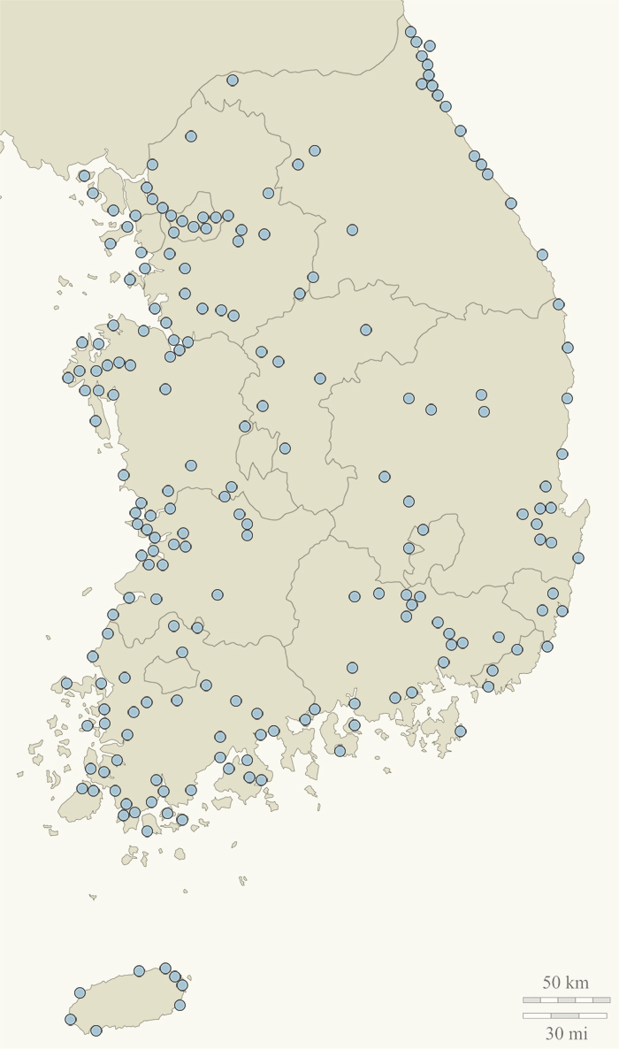
These pages show all available maps of the MoE Winter Census Locations.

There is no separate PDF for 2004 available; only a combined one for 1999-2004 which has no maps, therefore no maps for 2004 are available.

Select a location from the menu on the left or hold the mouse over a blue dot for the name and small map of the location and click on a dot or click on a location name from the list above to see a location's detailed information.